It wasn’t far from Fouriesburg to the border. After 20 minhtes of riding downhill I reached the crossing to Lesotho, country number 99.

Immigration was quick, as has been usual the last few crossings. My PCR certificate was on my phone rather than a hard copy, but no-one objected to that. After a few minutes I cycled off into the country.


Lesotho is very mountainous, with the highest elevation of any country. To begin with that manifested as constant ups and downs, none more than 100m.
I’d have liked to take some smaller roads across Lesotho but I couldn’t find many suitable ones. There were roads that linked communities this side of the mountain to the main road. There were also roads that link communities on the far side of the mountains to a road on the far side. But there were not many that actually cross the mountains. There’s a route on bikepacking.com, but it links two border crossings that have yet to reopen following covid-related closures. This meant I spent much of my time on paved roads.

For the first few hours I rode along a populated stretch of land next to the border, which leads to the capital. Before actually reaching the city, I turned off and followed one of the few dirt that seemed a sensible alternative.

The people of Lesotho are called the Basotho – in both cases, the last two syllables are pronounced “ootoo.” Most people nowadays wear western clothing, but herders still occasionally wear the blanket that is traditional Basotho dress.

This road climbed for a few hundred metres, before settling into the usual ups and downs. Some of the steepest sections were paved with concrete.

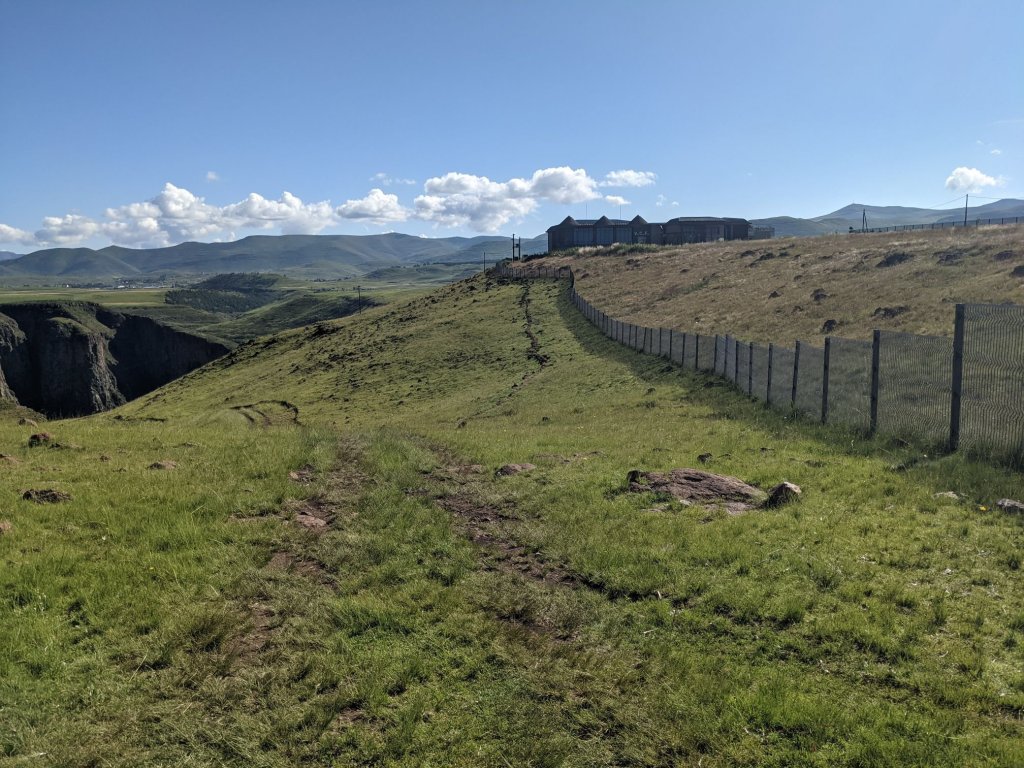
I had a brief return to tarmac, and passed the first police checkpoint in a long time. The reason for both of these became clear as I reached a dam.

After cycling across the dam the road reverted to dirt, and to uphill.

I cycled on until a few minutes before sunset, when I saw some trees a short distance from the road. I made my way over. The ground was mostly sloping, except for a small rock shelf. I set up my tent there, using rocks to secure the tent instead of pegs.

As I usually do, I set off cycling again in the morning. The first few kilometres were on a dirt road, climbing gradually upwards.

I joined a tarmac road for a little while which climbed steeply up to a pass through the mountains. I went up about 400m, to an elevation of 2300m.


After descending into a valley on the other side, I turned off onto another dirt road. It roughly followed the course of the river along the valley.

While the river obviously wound it’s way around the hills, the road did not. Instead it typically went up and over them, making for substantially more climbing than you might expect from riding downstream by a river.

After a while of this, the road moved away from the river and began climbing up to a pass. It was steep, though of a solid enough surface that I could ride out of the saddle. I was glad it was still morning so the temperature was low while I climbed.

A more gradual descent followed, bringing me to a village where I rejoined the tarmac road. From here the road made its way up and down, up to 2000m then down to 1650m.

At one point, while I was sitting taking a break by the side of the road, a man came to talk to me. He introduced himself as Johnny, and asked me to look at his tomatoes – not a euphemism! He had a few greenhouses and in one, the tomatoes were rotting while on the vine. He asked if I had any idea why it might be. I googled it and the answer seemed to be a lack of calcium, either due to insufficient fertilizer, or insufficient wafer to draw the calcium out of the ground.
I continued riding, and began the long climb of the day, starting at 1650m and ending at 2750m, with a few small descents along the way. The first section was the most difficult, being both steep and in the hottest part of the day.
I stopped for a break part way up. It was a reasonably populated area so some kids gathered around to watch me and yell out the usual things – hello, how are you, give me money, give me food, give me drink.
I resumed cycling, on a climb which became ridiculously steep. It must have been well in excess of 20%. There were three lanes – two going up, one going down. A few cars passed me, and they were zigzagging across all three lanes. I did the same and even so, it was tough!
The road levelled out a bit before resuming the climb, though significantly less steeply. From here on it was rarely much more than a 10% gradient, at least not for long.

Some dark clouds rolled in, looking ominous. In the end they passed by without anything worse than a drizzle.


Finally I reached the end of the climb. I made a bit of a start on the descent, then collected some water from a stream and set up camp. There were cows near where I camped, and after a while I saw their herder watching from a mountain ridge. Later on he came down to see me. He was just curious, and had no issue with me camping there.
I had camped at an elevation of roughly 2400m, which was high enough for it to be a little chilly at night. It was fine in the tent, but I waited for the sun to rise above the mountains before I started packing up.

The day began with a descent, ending after about half an hour when I turned off onto a dirt road, taking a detour to visit a waterfall.

Another 8 kilometres or so brought me to a big visitor centre, which seemed rather optimistic. It was shut at the time but I was able to get to a viewpoint nonetheless.

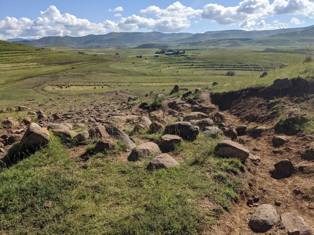
I took a different route back to the road. It was shorter but much rougher and sometimes unrideable. It wasn’t any faster but it was more interesting, and it was nice to avoid backtracking.

It was now the weekend, so there were a lot more kids around. The level of begging was higher than anywhere since Rwanda. The adults I spoke to in Lesotho were friendly, but the kids kept up a constant stream of “give me” – money, sweets, or anything else they could think of.
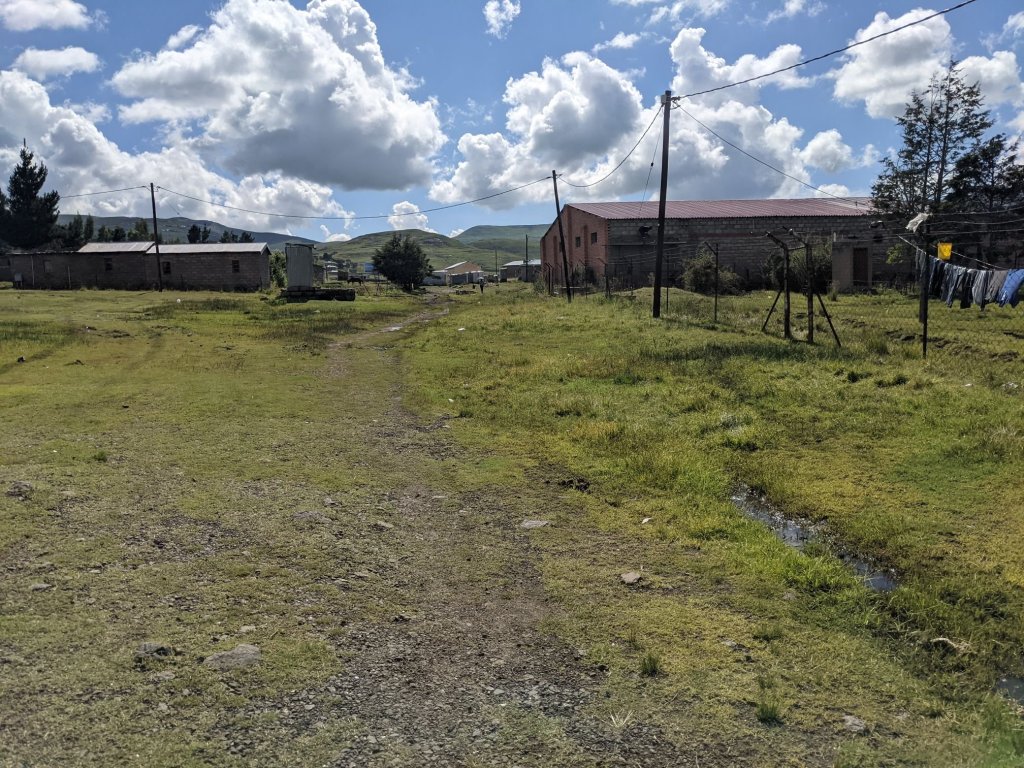
This brought me to the town of Semonkong. There was a small supermarket here where I bought some food. I loaded up my bike outside the shop, as other customers loaded their shopping onto donkeys.
There was a cabin selling food at the edge of town. They had sausages (although, in southern Africa, they’re called Russians) and fried dough balls – very fresh and still warm.
The road climbed back up a few hundred metres before beginning a long descent, ultimately going from about 2600m to 1500m. As is typical for Lesotho, it was not consistent, and the downhill was punctuated by several steep climbs.


The last little bit was finally an uninterrupted descent. Well, uninterrupted by climbs; I did stop to take a photo of a particularly large boulder blocking the road, just after a sign warning of rockfalls.

The rest of the day was of course a lot of up and down, but not of the same magnitude as before – generally just a couple hundred metres at a time.

In the evening I stopped at a shop and bought a cold drink, and asked about filling up my water bottle. Someone led me to the village tap. The guy’s name was something like Rarata, and I think he was a vet.
I rode a little out of the village before spotting a dip in the ground that would be out of sight of the road, and made my way over there to camp. I did here a couple of men walking and talking quite close by. I’m not sure if they saw me but, if they did, they left me be.
I was up early and cycling along. After a descent, I experienced something that was a rarity in Lesotho – a flat road! For several kilometres I followed a river, with minimal elevation change.

Of course this was just an aberration and soon it was back to the typical relentless verticality. Up and down, up and down. Of course it felt like a lot more up than down, but that’s cycling for you!


It was quite humid early on, but that lessened as the morning passed by. Late in the morning, the hills trended upward and brought me to Qacha’s Nek, a border town. I stopped at a supermarket to use up the last of my currency. The total came to about 20 loti less than I had. Well, I had no choice but to get an extra chocolate bar; such hardship.
A short final climb brought me to the border. I was stamped out of Lesotho and it wasn’t long before I was stamped into South Africa too. The only delay was when the South African immigration official tried to make sense of my various entry and exit stamps: there are a lot of them. I’d been expecting to get a rapid test at the border but, as it turned out, no one objected to my 5-day old PCR from Bethlehem. I cycled on, and admired the view.

The road on the South African side was unpaved and very bumpy, so it was a slow descent. It felt like I was putting almost as much work into braking downhill as I had into pedaling uphill! After 20 kilometres I reached a town, and tarmac resumed.

Another 10 kilometres brought me to a larger town. I went to a supermarket, then to a campsite. It was only early afternoon but I needed to take a shower and do laundry, so I stopped early. It helped that the campsite was cheap, too, at 80 rand (£4).
Mar 10: 140 km
Mar 11: 95 km
Mar 12: 96 km
Mar 13: 80 km

Hi Sam
Fascinating following your up and down journey through Africa. I’m loving it. Maybe it’s the simplicity of the blog journeying along the roads/tracks with no sign of the metropolis !
Can I ask what motivated you to take this journey ? Lynda
LikeLike
Thanks Lynda! I do try to avoid the cities, and when I have to go there anyway I don’t have much to say about them anyway.
Honestly my motivation was just the idea that travelling seemed more interesting than getting an internship over the summer while at Uni. I enjoyed that and so when I graduated I planned to travel for a few months… Then a bit more, and a bit more, and here we are.
LikeLike